
Flows and tides
During extreme flows, bridges and culverts face significant stress. SMHI's calculations can be used as a basis for dimensioning and permit assessments, and can also demonstrate the impact of a changing climate.

In order to facilitate the planning of constructions in water, it is important to look at both statistics and future predictions. We can supply information, with the help of both historical data and future climate scenarios, to comply with safety requirements.
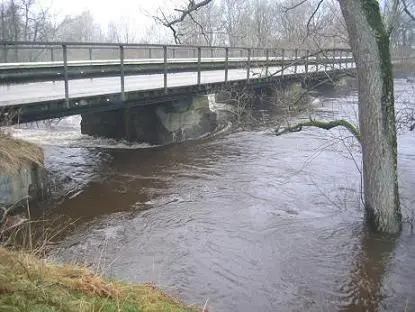
High water flow around bridge abutment
Climate-adapted design flows
By employing various regional climate scenarios alongside hydrological model calculations, we can develop different hydrological scenarios. Frequency analysis of these scenarios provides insight into how uncertainties introduced by climate change affect the results of traditional dimensioning data.
- Highest High Water with a 100-Year Return Period (HHQ 100): Calculated based on historical data.
- Assessment of Future Mean Flows (MQ) and Highest High Water (HHQ 100): For example, for the period 2071-2100, expressed as a percentage of current levels.
A large variety of services
SMHI offers a comprehensive range of dimensioning services, including:
- Calculation of river flow rates, for instance, for road and bridge construction.
- Calculation of water levels during high and low water events and extreme flow scenarios.
- Assessment of future water levels and flows according to climate scenarios.
- Statistical analysis of historical data.
- Data for environmental impact assessments.
- Data for flood mapping.
Results are presented in a clear report, detailing various flow levels with different return periods according to the customer’s needs.
Difference between Vattenwebb and DimQ data
Dimensioning calculations are determined using average calculations and statistical analysis of time series from nearby stations. Information from locations with similar flow dynamics and lake area is factored into the final results. This methodology ensures the high site-specific accuracy required for dimensioning assessments. Results from these assessments may differ from the flow statistics presented in Vattenwebb External link. because Vattenwebb’s calculations are based on hydrological model outputs from a generally calibrated HYPE model for Sweden (S-HYPE). The S-HYPE model calculates data for a large number of points, making manual review of each point impractical.
