Prevent flooding with mapping assistance
In a future climate, flooding caused by heavy rainfall, high river flows, and rising sea levels is expected to become more common. SMHI conducts mapping and risk analyses for various types of flooding, providing valuable decision-support tools. These studies can also propose and evaluate measures to address identified flood risks.
Flooding along waterways is a recurring issue for low-lying areas. For example, detailed planning of construction near water requires precise calculations of water levels. Heavy rainfall can also cause flooding in communities, where a heavy rainfall mapping indicates where the community is vulnerable to such events and where preventive and immediate post-rainfall measures are needed. SMHI performs various types of flood mapping depending on the customer’s needs.

Flood mapping for high flows
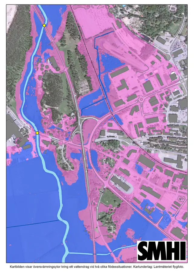
Flood mapping for high flows in waterways is based on an inventory of available information for the watercourse of interest, such as terrain models, roughness inside and outside the riverbed, and structures like bridges and culverts. This is often combined with measurements of cross-sections, flows, and water levels. Using these measurements and hydraulic models, water levels and extent of flooding under different extreme flow scenarios are calculated. The extent of flooding is presented in map format, making it easy for you to quickly assess areas at risk of flooding.
Heavy rainfall mapping
Heavy rainfall mapping shows where water from intense precipitation is likely to accumulate and cause flooding problems that can disrupt properties and other infrastructure. SMHI tailors the level of mapping to your needs and performs both low-point mapping and analyses using two-dimensional hydraulic surface runoff models. Surface runoff models are based on terrain analysis supplemented with information about the land’s drainage capacity, such as roughness, infiltration, and any drainage systems. The model is simulated with rainfall corresponding to a specific return period, duration, and climate scenario. Collaboration with SMHI’s meteorologists, statisticians, and climate experts ensures that the rainfall mapped aligns with the latest climate research. For sensitivity analysis, different rainfall scenarios and varying infiltration capacities can be simulated. The results are delivered as easily interpretable maps and digital GIS files that can be easily integrated into your GIS systems.
Assistance with decision-making
SMHI can assist you with:
- Calculating water levels and flood extent along waterways during high flows.
- Calculating water depth and flood extent on land during heavy rainfall.
- Assessing flood risks in current and future climates.
- Developing appropriate action options with simulation of measures.
- Compiling data for detailed planning, comprehensive planning, or permit applications.
Your needs determine which return periods and climate scenarios are analyzed for future climates and how the results are presented. Feel free to contact us to learn more about how we can assist your organization in climate adaptation efforts.
Reference project
Skyfallsplan klar för Borås Stad
SMHI’s consulting services have assisted Borås City in mapping heavy rainfall risks and developing a preliminary action plan for managing these risks.
The strategic heavy rainfall plan is now complete for Borås City (In swedish) External link.


