
Scientific focuses
Water is vital to life! It affects many aspects of the environment, the society and our health. Therefore, there are many questions that we want answers to.
SMHI hydrological research unit has a long tradition of applied research and is involved in many national and international projects. Existing applications cover aspects like runoff forecasting, spillway design, flood risk, hydrochemical modelling, fire hazard and effects of climate change.
Our aim is to improve the hydrological production chain that provides answers to our water related questions and distributes this information to different kinds of users.
Current scientific focuses
At present we mainly address the following challenges: nature based solutions and new data sources in process based hydrological modeling.

Hydrological production chain
Hydrology at SMHI can be categorized into five areas, which correspond to components in a production chain of water information.
This chain is used to deliver decision support to authorities and companies considering, for instance, safety, water management, environmental aspects, dimensioning of infrastructure and climate impact.
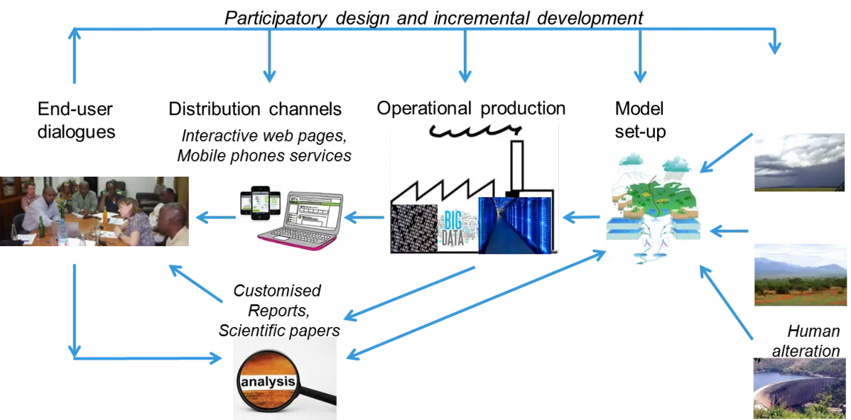 Zoom image
Components in the hydrological production chain at SMHI.
The results are distributed as interactive web pages, reports, software, files or scientific articles dependent on the receiver. Most parts of the operational production is automated, such as storage of real time data and computation of forecasts. Computations are made on office PCs, SMHI servers, at the super computer center (NSC) or in the cloud. The products are maps and time series, usually based on a model setup for a specific area.
Daily hydrological forecasts are produced for the full area of Sweden and Pan Europe. Our numerical water models predict the water balance and river flow for the whole globe. Several large-scale assessments have been performed in the Arctic area, India, the La Plata river, the Niger river and The Middle East/North Africa. On a smaller scale, we often work with customers on specific model applications, for example with hydropower companies and municipalities.
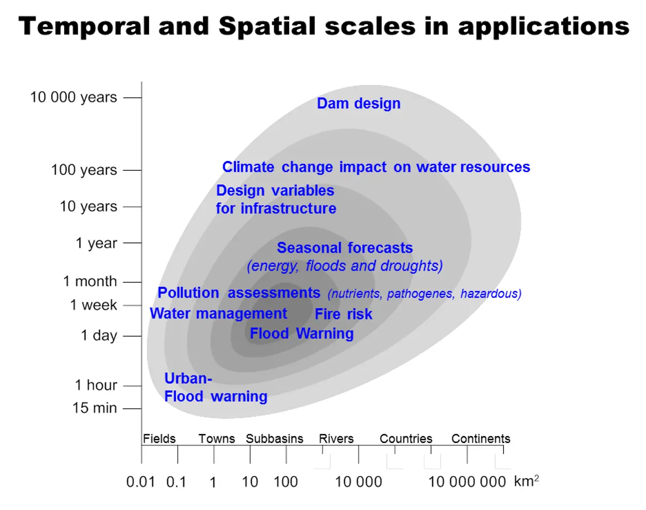 Zoom image
Hyrological models are applied on many different temporal and spatial scales.
Every model application requires input data from a large number of databases that are preprocessed and adjusted for the computations. The combination of observations and model calculations result in cost efficient decision support. The hydrology is mainly driven by landscape features and meteorology, so input from meteorological observations and models are crucial.
The hydrological production chain is constantly developed based on requests from external users. The numerical calculations are available as maps, graphs and download on our HYPE website HYPE-web. It is also possible to order data deliveries from HYPE in standardized or costumized formats.

Previous research focuses
Where on earth is the water? Large-scale hydrological modelling.
How can we accelerate climate actions and secure sustainable water resources? Water and Climate Services.
How does global warming affect the hydrological cycle? Hydroclimatology.
How do we get ahead of the flood? Small-scale hydrological modelling.
Is the river clean enough? Water quality deterioration.